1 km
1 mi
Leaflet | Tiles © Esri — Esri, DeLorme, NAVTEQ, TomTom, Intermap, iPC, USGS, FAO, NPS, NRCAN, GeoBase, Kadaster NL, Ordnance Survey, Esri Japan, METI, Esri China (Hong Kong), and the GIS User Community

A work in progress to make a simple map based collaborative database of paragliding sites, clubs and pros worldwide.
The data provided on this site is for informational and planning purposes only.
Absolutely no accuracy or completeness guarantee is implied or intended. All information on this website is for informational purpose only and must not be used and trusted 'as is'. Please understand that it may be outdated, unclear, or simply wrong !
We hope you are aware that you can not trust anything you read on the internet: the website owner can not be held responsible for any decision taken on the basis of the information presented here : please always consider getting fresh and official legal information from the flying sites local people, clubs and/or authorities and consider the weather carefully before you go fly !
This beeing said, fly happy and safe ! ;)

This work and your contributions are licensed under Creative Commons Attribution-Share Alike 3.0 Unported License.
Starting December 10th of 2024, new contributions will also be added in a separate database licenced under ODbL 1.0.
Website built with Leaflet, from a bootleaf basis.
A big thank you to the "Ducks Parapente" pg club in Grenoble - fr, for offering hosting to the project.

A big thank you also to paraglidingforum.com for having kindly offered pgearth a free hosting for over a decade ! Bless you, guys !
And of course a big thank you to all contributors !! :)
We care about your privacy : our code is google tools and facebook buttons free so no-one at gafam will ever track you here !
Don't thank us, it's our pleasure !
This beeing said, we tried our best, but they must know you're here anyway... ;)
We also try to use as few cookies as possible, which is why you have to login at every connection, sorry for the inconveniance.

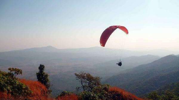
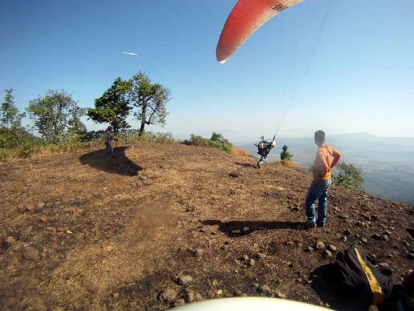
| takeoff | The takeoff is motorable about 7 kms of off road driving will take you 2000feet high. From the point of parking your car takeoff is about 10 minutes walking distance. The takeoff area is big but a rocky. The place is isolated and forested so not suitable for venturing out alone. |
|---|---|
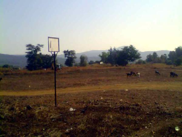
| landing | There are plenty of landing options in gliding distance. You can choose an area close to the road and make your landing approcah. |
| weather | No known weather hazards. Flyable only in morning. The area is forested, isolated and has wild cats. Not suitable to fly without local support. |
| rules | None as of now except using common sense of not disturbing the forest, people and culture or the region. |
| access | Best option is to contact www.spaceapple.com. The location is 60kms northwest of Mumbai airport. Drive on NH8 and take a right turn for Vajreshwari. Ask for Parol phata. half a km before parol phata is the dirt road which will take you to top of Tungareshwar. This dirt tract is maintained by Balyagi Sadanand Maharaj ashram trust. |
| comments | Good site for flying close to Mumbai. The height difference provides a 15 minute flight to anyone who takeoff with his paraglider. This is a morning site and takes easterly winds. It is forested without much barren ridge top to give ridge lift. Newly found site which needs to be explored. |
| contact | |
| web | |
| tourism |
Courtesy of windy.com